The hill towns
Neerim South got its railway in 1892. Rokeby, Buln Buln and Jindivick are in the hills north of Warragul; Willow Grove is to the east; Thorpdale is south across the highway in a former volcanic crater the shire's potatoes grow in, with a township heritage precinct of its own. The housing is farmhouses, railway-era and interwar weatherboards, post-war fibro and weatherboard, and houses built since on sloping blocks with a view. Much of it is on stumps, and because the ground slopes the stumps are tall on one side and short on the other.
The ground
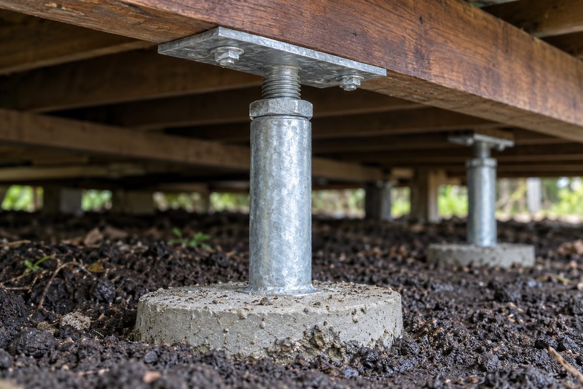
Red ferrosol, which Victorian Resources Online describes as very deep, well drained, moderately to strongly acidic volcanic soil on the rolling hills of the Warragul and Thorpdale districts, and which the Department of Agriculture's West Gippsland guide calls the krasnozems of the Warragul, Neerim and Thorpdale areas, deep, friable and well drained. Three things follow for a house. The holes dig easily and drain by themselves, so the digging is the easy part. The red soil is described as deep and well drained rather than reactive, so a floor that has dropped on the hills is more often a stump that rotted or sank than the ground moving under it, and a site test confirms. And the acidity is hard on untreated timber and unprotected steel, which is why the replacement is concrete, or galvanised steel on a concrete pad that keeps the steel out of the soil.
Sloping blocks
A house on a hill sits on a platform that was cut into the slope on the uphill side and built up with the spoil on the downhill side. The uphill stumps are short and in natural ground. The downhill stumps are tall and in fill, and fill settles. So the downhill side drops, the floor tilts toward the view, and the uphill side stays where it was. Water adds to it: on a cut block the subfloor on the uphill side is below the level of the yard, and ground water moves through the soil into it.
| Finding on a hill block | What it means | What is done |
|---|---|---|
| Downhill side dropped, uphill side level | Fill under the tall stumps has settled. | Downhill stumps replaced deeper, to natural ground, on pads. Adjustable steel so they can be relevelled if the fill keeps going. |
| Uphill stumps rotted, downhill sound | Water from uphill is running into the subfloor. | Agricultural drain along the uphill wall, regrading, then stumps. |
| Whole house creeping downhill, cracks in the platform | The ground is moving, not the stumps. | Engineer first. Stumps are not the answer to a slope that is failing. |
| Tall stumps unbraced, house sways | Tall stumps need bracing the original builder skipped. | Bracing between stumps as part of the restump, on the surveyor's requirements. |
Landslip
The West Gippsland Regional Catchment Strategy says parts of the Strzeleckis are very prone to sheet, tunnel, gully and stream bank erosion and that landslips are common. The Gazette reported slips on five roads after heavy rain in October 2020, including the Warragul-Leongatha Road at Seaview and the Yarragon-Leongatha Road at Allambee, and the June 2021 storm, which dropped 280 mm on Mount Baw Baw in a day, closed 45 kilometres of the Mount Baw Baw Tourist Road with slips and brought minor flooding to Willow Grove. The Baw Baw Planning Scheme has an Erosion Management Overlay for this kind of ground; whether it covers a particular block is a VicPlan question. On any steep block where the ground itself may be moving, a structural or geotechnical engineer looks before a restumper quotes, and the underpinning page explains what an engineer's design looks like.
Bushfire
Council's page says the Bushfire Management Overlay already applies to bushfire risk areas in the shire and around 3,067 more properties are proposed to come into it. Separately, bushfire construction standards apply to designated bushfire prone areas under the Building Act. A restump does not change a house's bushfire rating, but a building permit in a bushfire prone area carries construction requirements and the surveyor says whether any affect the subfloor, for instance enclosing it or screening the vents.
Rules and access
Baw Baw Shire's rules apply across all of these towns: a building permit from a private registered building surveyor, a Commission-registered builder at any value, a council asset protection permit, the $10,000 contract and $20,000 Home Warranty thresholds. Access is the practical difference. A farmhouse at Rokeby has room for a machine; a house on a steep block at Neerim South may have every stump and every barrow of spoil carried up or down by hand, which is priced per stump like everything else. The cost guide explains how.
What cannot be fixed on a hill
A slope that is failing. If the platform is moving, no stump holds the house still, and the engineer's answer may be piers, retaining or drainage well above the house. Fill that keeps settling, which adjustable stumps manage but do not cure. And ground water coming down the hill, which an uphill drain intercepts only if it has somewhere to go. The restumper fixes the house. The engineer and the drainer fix the hill.
Check the current rules before you rely on this
This page describes restumping on the red-soil hills and the Strzelecki foothills around Neerim South, Rokeby, Willow Grove and Thorpdale in Baw Baw Shire. It describes the rules in general terms as they stood in October 2026. Standards, forms, thresholds and fines change.
The authoritative sources are Victorian Resources Online on red ferrosols, Department of Agriculture, managing soils under intensive cropping in West Gippsland, West Gippsland Regional Catchment Strategy, Strzelecki local area, Warragul and Drouin Gazette, January 2021, on landslips after October rain, Department of Transport presentation on the June 2021 storm, Baw Baw community meeting, VICSES presentation on the June 2021 storm, Baw Baw community meeting, Baw Baw Shire Council on the Bushfire Management Overlay and Baw Baw Heritage Permit Exemptions Incorporated Plan. Where anything here differs from those sources, they are right and we are not.
We are not building surveyors, engineers, planners or lawyers. For what applies to your house, ask a registered building surveyor or ring Baw Baw Shire Council on 03 5624 2411.
Accurate at the time of writing, October 2026. Always check the source before relying on it.